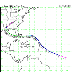
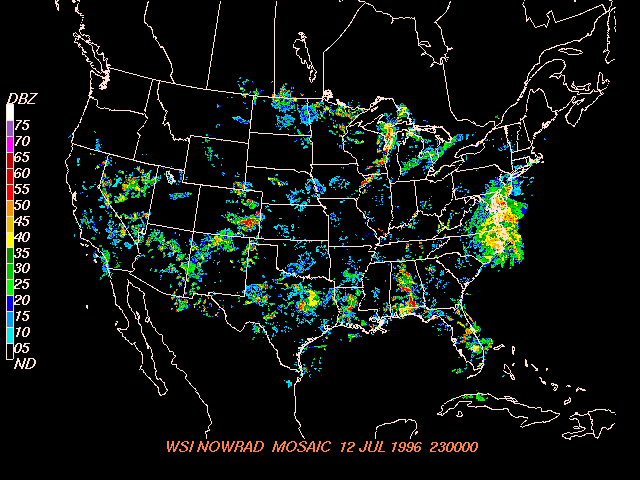
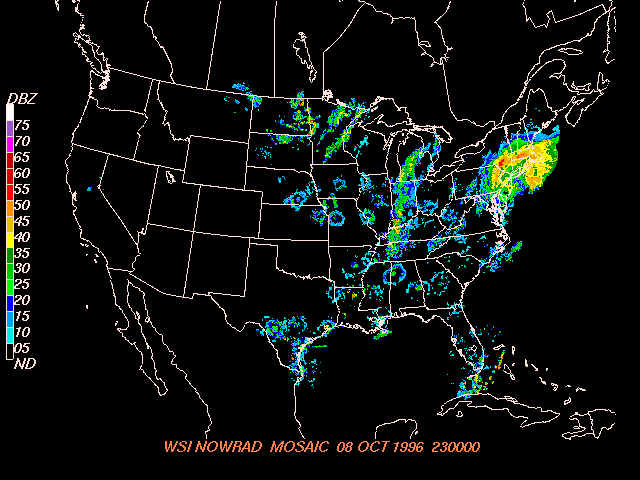
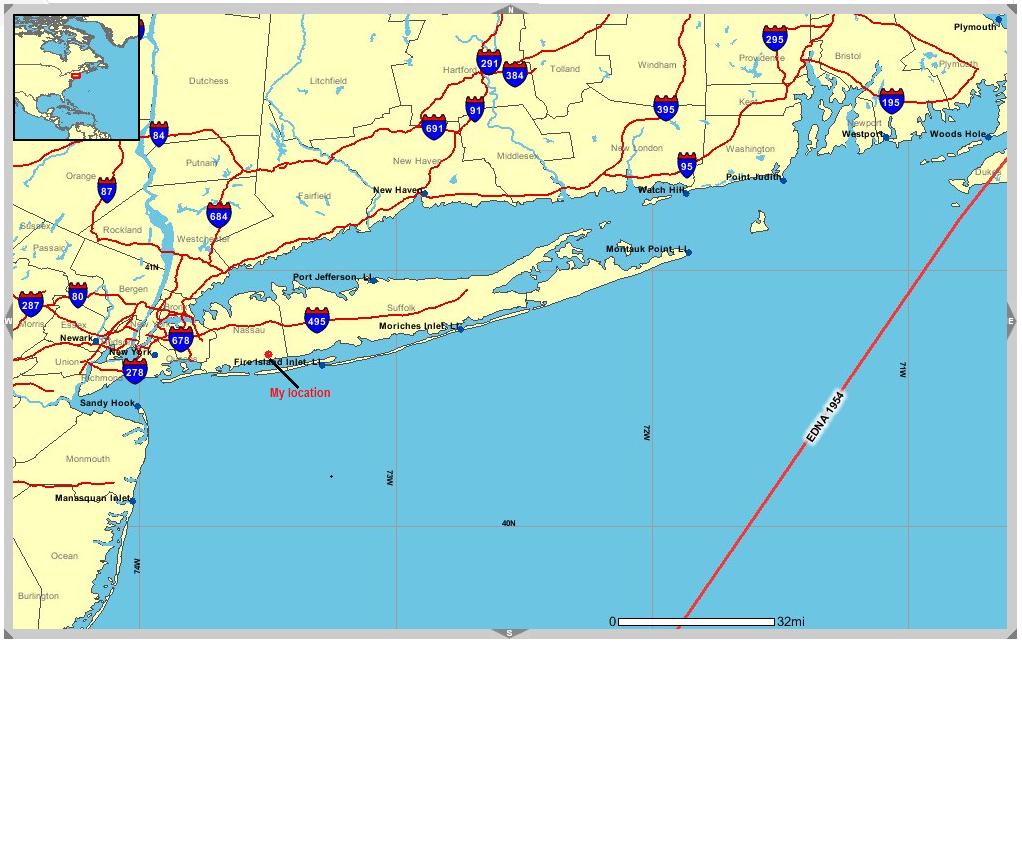
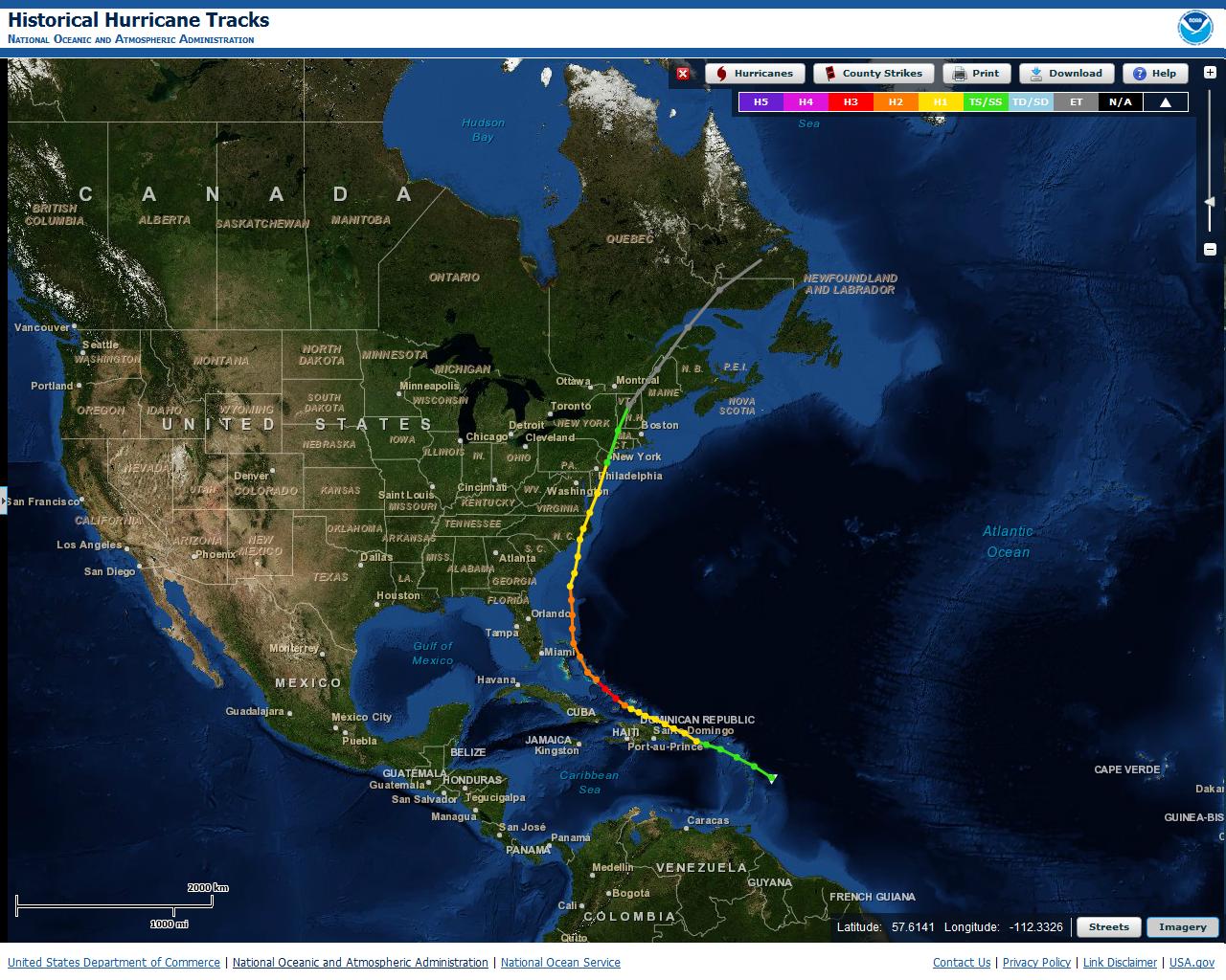
As Hurricane Irene moved north along the Atlantic coast and interacted with land, it weakened and made its second landfall as a Tropical Storm near Little Egg Inlet along the southeast NJ Coast on August 28, 2011 around 5:35 am EDT. Tropical Storm Irene made its third landfall in New York City around 9:00 am.||Irene brought sustained tropical storm winds, heavy rain, and destructive storm surge along with two confirmed tornadoes.||Seven deaths occurred:||one 53 year old man was found dead after a 3 hr. rescue effort after his boat overturned in strong rapids while boating in the Croton River in Croton (Westchester County)||one 68 year old man drowned in a marina off City Island in the Bronx; where he had gone to check on his boat.||one 52 year old man drove through flood waters around 3 barricades and drowned in the Town of Tuxedo in Orange County, NY.||one older man died wind surfing in Suffolk County during the afternoon of 8/28/2011||one 51 year old man fell 30 feet from a 60-foot high tree while trimming large tree branches in Roslyn Heights in Nassau County on 9/9/2011.||one child came into contact with downed electrical wires and was electrocuted in Rockland County; died 9/10-11/2011||one man came into contact with downed electrical wires and was electrocuted in Rockland County||At least 600,000 people were ordered (both voluntary and mandatory) to evacuate from storm surge and fresh water inland flooding.||Widespread power outages lasted up to 1 week following Tropical Storm Irene.al Storm Irene tracked north northeast across eastern New York and western New England during Sunday, August 28th, producing widespread flooding, and damaging winds across the region.||Irene tracked from a position over New York City around 8 AM EST Sunday, to approximately 10 miles west of Danbury, CT at 10 AM EST, to approximately 15 miles south of Pittsfield, MA at 1 PM EST Sunday, to approximately 65 miles south of Rutland, VT at 4 PM EST.||The greatest impact from Irene across eastern New York and western New England was heavy to extreme rainfall, which resulted in catastrophic flooding across portions of the region. Rainfall amounts generally averaged 4 to 8 inches across the region, although amounts of 8 to 12 inches were common across higher elevations within the eastern Catskills and Schoharie Valley, with isolated amounts as high as 18 inches reported. Three to 6 inches were common across the Lake George and Saratoga regions, with 3 to 5 inches common across much of the Mohawk Valley, although locally higher amounts of up to 8 inches fell across extreme southwest Herkimer County, while amounts of 1 to 3 inches fell across the western Adirondacks. Much of the rain which fell occurred within a 12 hour period, beginning early Sunday morning, and ending Sunday evening.||This heavy to extreme rainfall resulted in widespread flash flooding and river flooding across eastern New York. Bridges were closed on I-90, I-88, US Route 20, New York Route 7, New York Route 5S, New York Route 161, New York Route 30, and all bridges over the Schoharie Creek, from the Gilboa Dam to the Mohawk River. The bridge on Route 85 at Onesquethaw Creek was closed due to a westbound lane washout. The Route 146 bridge over the Normanskill Creek in the Town of Guilderland was closed between Route 20 and Route 158.||In Greene County, catastrophic flooding was reported countywide, especially in the Catskill areas, where widespread evacuations and rescues occurred, along with widespread road closures and damage, and houses which were swept away. Record flooding most likely occurred on the Schoharie Creek at Prattsville before the gage was lost in the flood. In Schoharie County, catastrophic flooding also occurred throughout the Schoharie Valley, with widespread evacuations of 5000 occurring, including in the jurisdictions of Esperance, the Village of Central Bridge, Schoharie, Middleburgh, Blenheim, Gilboa, and Fulton. Numerous bridges were closed or washed out. The Schoharie Creek also broke previous record floods by 1 to 2 feet at the gages which were not washed away or damaged by the floodwaters. In Ulster County, extensive damage to roads, bridges, and electrical infrastructure was reported, with the majority of roads impassable across the Catskills. Five rescues were performed by the Ulster County Sheriffs Department swift water team for people driving into the water, with numerous mandatory evacuations also occurring. Record flooding occurred on the Esopus Creek at Cold Brook, the Rondout Creek at Rosendale, and the Hudson River at Poughkeepsie, with major flooding occurring on the Esopus Creek at Mount Marion.||In Schenectady and Albany counties, flash flooding was reported in numerous locations. In Schenectady County, evacuations of 300 to 400 people occurred in Rotterdam Junction, and the Stockade region of Schenectady. Over 70 roads were closed, including the New York State Thruway from exit 25A in Schenectady to exit 34A in Syracuse, a length of approximately 117 miles. In Albany County, numerous roads were also closed, including the New York State Thruway from exit 24 in Albany to exit 8 in White Plains due to flooding and downed trees. Major flooding occurred on the Hudson River at Albany, with moderate flooding occurring on the Mohawk River at Schenectady and Cohoes.||In Rensselaer and Dutchess counties, flash flooding was reported in several locations. In Dutchess County, numerous roads and bridges were closed or damaged due to flooding and downed trees, with mandatory evacuations reported. In Rensselaer County, numerous road closures were also reported, with one bridge damaged, and 60 evacuations reported. In addition, record flooding was reported on the Hudson River at Poughkeepsie, while major flooding occurred on the Hoosic River at Eagle Bridge, on the Hudson River at Troy, and on Wappingers Creek at Wappingers Falls. Moderate flooding was reported on the Tenmile River at Webatuck, with minor flooding occurring on the Hudson River at Waterford.||In Washington and Saratoga counties, flash flooding was reported in numerous locations, with numerous roads closed due to flooding and downed trees and power lines. Evacuations were also reported, including in Waterford. Also, record flooding occurred on the Mettawee River at Granville, with moderate flooding occurring on the Battenkill at Battenville, on the Mohawk River at Cohoes, and minor flooding on the Hudson River at Waterford.||In Montgomery County, flash flooding was also reported in numerous locations, along with many road closures, and approximately 1000 evacuations. Record flooding occurred on the Canajoharie Creek in Canajoharie.||In Herkimer County, flash flooding was reported countywide, with a debris flow reported in Frankfort, along with numerous road closures due to flooding and downed trees. A mudslide was reported along New York State Route 51. In addition, in the Village of Frankfort, approximately 80 elderly residents of an apartment building were evacuated.||Flash flooding was also reported in numerous locations within Warren, Fulton and Columbia counties. In Warren County, more than 40 roads were closed due to flooding and downed trees. In Columbia County, numerous roads were also closed due to flooding and downed trees. In addition, approximately 1000 people were evacuated from the area around the Philmont Dam due to concerns about a possible dam compromise. Minor flooding was reported on the Sacandaga River at Hope in Hamilton County.||Four deaths occurred due to flooding from Irene. In Greene County, one death occurred when a woman drowned when the house she was in was swept away by floodwaters in Maplecrest. A man drowned when the embankment he was standing on gave way and swept him into Stony Clove Creek in Lanesville. In Albany County, a woman was washed into Onesquethaw Creek in the town of Clarksville and drowned. In Montgomery County, a man drowned when the truck he was in was swept away by the Schoharie Creek on Route 5S.||Strong winds also occurred across eastern New York, with frequent wind gusts of 35 to 55 mph, along with locally stronger wind gusts exceeding 60 mph. The strongest winds occurred from the north to northeast during the morning hours, then from the west to northwest during the mid to late afternoon hours. The combination of strong winds, and extremely saturated soil led to numerous downed trees and power lines across the region. This also resulted in widespread long duration power outages.||In particular, the approximate number of customers affected by power outages included:||Albany County, 36000.|Columbia County, 6000.|Dutchess County, 25000.|Fulton County, 7000.|Greene County, 18000.|Hamilton County, 7200.|Herkimer County, 2500.|Montgomery County, 7000.|Saratoga County, 24000.|Schenectady County, 26000.|Schoharie County, 9000.|Warren County, 23000.|Washington County, 4500.|Ulster County, 60000.
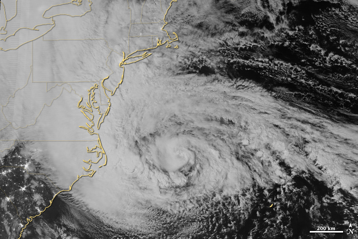
After killing almost 70 in the Caribbean, Sandy smashed into the eastern seaboard of the U.S. on Monday, Oct. 29, 2012, bringing with her high winds, destructive tides, and snow. Hardest hit were New York, New Jersey, Pennsylvania, and Maryland. With a death toll climbing past 125 and an economic cost estimated at $50 billion, Superstorm Sandy is a force to be reckoned with. In comparison, 2011's Hurricane Irene claimed 44 lives and cost $10 billion, while Katrina still reigns as this country's and century's worst natural disaster, with at least 1,836 people lost and damages estimated at around $125 billion. Superstorm Sandy's dubious honors include the highest storm surge of 13.88 ft (4.23 m) at Battery Park, N.Y; and record low barometer readings in New Jersey, Pennsylvania, and Maryland around the 948 mb mark. Sandy was also, even against hurricane standards, exceptionally large, with hurricane-force winds covering a 175-mile distance from her center, and tropical storm-force winds extending beyond a 500-mile radius. With such wind velocity and range, it is not surprising that the U.S. Department of Energy reported more than 8.6 million people without power in the superstorm's aftermath, leaving more people in the dark than any other storm in history.
New York
Manhattan suffered a widespread power outage during the storm. Governor of New York Andrew Cuomo declared a statewide state of emergency and asked for a pre-disaster declaration on October 26 which President Obama signed later that day. By October 27, major carriers canceled all flights into and out of JFK, LaGuardia, and Newark-Liberty airports, and the Metro North and Long Island Rail Roads suspended service. The Tappan Zee Bridge was closed, and later the Brooklyn Battery Tunnel and Holland Tunnel were also closed. On Long Island, an evacuation was ordered for South Shore, including areas south of Sunrise Highway and north of Route 25A and in elevations of less than 16 feet (4.9 m) above sea level on the North Shore. In Suffolk County, mandatory evacuations were ordered for residents of Fire Island and six towns. Most schools closed in Nassau and Suffolk counties on October 29.
The Brooklyn–Battery Tunnel remained flooded on the Tuesday morning after the storm.
New York City began taking precautions on October 26. Governor Cuomo ordered the closure of MTA and its subway on October 28, and the MTA suspended all subway, bus, and commuter rail service beginning at 7 p.m. EDT. After Hurricane Irene nearly submerged subways and tunnels in 2011, entrances and grates were covered just before Sandy, but were still flooded. PATH train service and stations as well as the Port Authority Bus Terminal were shut down in the early morning hours of October 29.. Later on October 28, officials activated the coastal emergency plan, with subway closings and the evacuation of residents in areas hit by Hurricane Irene in 2011. More than 76 evacuation shelters were open around the city.On October 29, Mayor Michael Bloomberg ordered public schools closed and called for a mandatory evacuation of Zone A, which comprises areas near coastlines or waterways. Additionally, 200 National Guard troops were deployed in the city. NYU Langone Medical Center canceled all surgeries and medical procedures, except for emergency procedures. Additionally, one of NYU Langone Medical Center's backup generators failed on October 29, prompting the evacuation of hundreds of patients, including those from the hospital's various intensive care units. U.S. stock trading was suspended for October 29–30.
New Jersey
Airmen of the New Jersey National Guard's 108th Wing assemble before being sent to assist at various emergency shelters.
Preparations began on October 26, when officials in Cape May County advised residents on barrier islands to evacuate. There was also a voluntary evacuation for Mantoloking, Bay Head, Barnegat Light, Beach Haven, Harvey Cedars, Long Beach, Ship Bottom, and Stafford in Ocean County. Governor of New Jersey Chris Christie ordered all residents of barrier islands from Sandy Hook to Cape May to evacuate, and closed Atlantic City casinos. Tolls were suspended on the northbound Garden State Parkway and the westbound Atlantic City Expressway starting at 6 a.m. on October 28. President Obama signed an emergency declaration for New Jersey, allowing the state to request federal funding and other assistance for actions taken before Sandy's landfall.
On October 28, Mayor of Hoboken Dawn Zimmer ordered residents of basement and street-level residential units to evacuate, due to possible flooding.On October 29, residents of Logan Township were ordered to evacuate. Jersey Central Power & Light told employees to prepare to work extended shifts. Most schools, colleges and universities were closed October 29 while at least 509 out of 580 school districts were closed October 30. Although tropical storm conditions were inevitable and hurricane force winds were likely, the National Hurricane Center did not issue any tropical cyclone watches or warnings for New Jersey. This decision was because Sandy was forecast to become extratropical before landfall and thus it wouldn't be a tropical cyclone.
Wind Reports:
PUBLIC INFORMATION STATEMENT
SPOTTER REPORTS
NATIONAL WEATHER SERVICE NEW YORK NY
854 AM EDT TUE OCT 30 2012
THE FOLLOWING ARE UNOFFICIAL OBSERVATIONS TAKEN DURING THE RECENT
STORM THAT HAS BEEN AFFECTING OUR REGION. APPRECIATION IS EXTENDED TO
HIGHWAY DEPARTMENTS...COOPERATIVE OBSERVERS...SKYWARN SPOTTERS AND
MEDIA FOR THESE REPORTS. THIS SUMMARY IS ALSO AVAILABLE ON OUR HOME
PAGE AT WEATHER.GOV/NYC
***********************PEAK WIND GUST***********************
LOCATION MAX WIND TIME/DATE COMMENTS
GUST OF
MPH MEASUREMENT
CONNECTICUT...
ANZ330...
2 S GROTON 76 300 PM 10/29 MESONET
...FAIRFIELD COUNTY...
BRIDGEPORT AIRPORT 76 549 PM 10/29 ASOS
GREENWICH 70 520 PM 10/29 TRAINED SPOTTER
NORWALK 69 830 PM 10/29 PUBLIC
TRUMBULL 68 540 PM 10/29 TRAINED SPOTTER
DANBURY AIRPORT 68 711 PM 10/29 ASOS
...MIDDLESEX COUNTY...
3 SW MIDDLETOWN 58 643 PM 10/29 MESONET
...NEW HAVEN COUNTY...
MADISON 85 520 PM 10/29 PUBLIC
...NEW LONDON COUNTY...
GROTON AIRPORT 75 335 PM 10/29 ASOS
STONINGTON 70 300 PM 10/29 EMERGENCY MNGR
NEW JERSEY
...BERGEN COUNTY...
1 SSE TEANECK 76 731 PM 10/29 MESONET
TETERBORO 72 747 PM 10/29 ASOS
NORTH ARLINGTON 63 348 PM 10/29 SKYWARN SPOTTER
...ESSEX COUNTY...
1 N MONTCLAIR 88 1020 PM 10/29 MESONET (this report has been determined erroneous)
NEWARK AIRPORT 78 751 PM 10/29 ASOS
FAIRFIELD 72 741 PM 10/29 MESONET
1 ESE FAIRFIELD 72 741 PM 10/29 MESONET
CALDWELL AIRPORT 70 614 PM 10/29 ASOS
...HUDSON COUNTY...
1 ENE BAYONNE 77 805 PM 10/29 MESONET
HARRISON 68 720 PM 10/29 CO-OP OBSERVER
...PASSAIC COUNTY...
CLIFTON 80 930 PM 10/29 SKYWARN SPOTTER
NEW YORK
...ANZ338...
2 N TOMPKINSVILLE 90 824 PM 10/29 MESONET
...ANZ355...
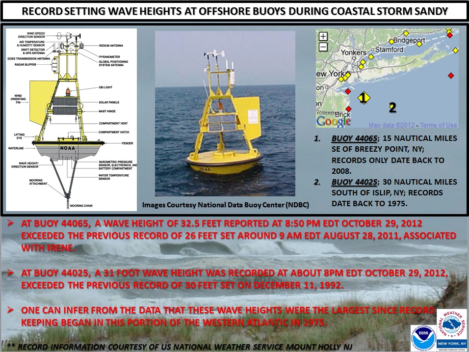
BUOY 44065 69 514 PM 10/29 NY HARBOR APPROACH BUOY
...ANZ370...
BUOY 44025 74 250 PM 10/29 BUOY
...KINGS COUNTY...
CONEY ISLAND 69 642 PM 10/29 MESONET
FLATBUSH 58 905 PM 10/29 MESONET
...NASSAU COUNTY...
SYOSSET 82 703 PM 10/29 SKYWARN SPOTTER
1 E POINT LOOKOUT 80 750 PM 10/29 JONES BEACH COAST GUARD
3 E LIDO BEACH 79 615 PM 10/29 MESONET
BAYVILLE 77 521 PM 10/29 MESONET
2 NNE GLEN COVE 77 521 PM 10/29 MESONET
OYSTER BAY 67 338 PM 10/29 SKYWARN SPOTTER
...NEW YORK COUNTY...
CENTRAL PARK 62 313 PM 10/29 ASOS
...ORANGE COUNTY...
ORANGE LAKE 61 745 PM 10/29 MESONET
MONTGOMERY 58 740 PM 10/29 ASOS
...QUEENS COUNTY...
2 SSE JACKSON HEIGHT 79 802 PM 10/29 MESONET
NYC/JFK AIRPORT 85 802 PM 10/29 ASOS (direction 100 degrees)
BREEZY POINT 78 830 PM 10/29 MESONET
NYC/LA GUARDIA 74 655 PM 10/29 ASOS
..SUFFOLK COUNTY...
EATONS NECK 96 655 PM 10/29 MESONET-ELEVATED 71FT (Est 87 mph at 10m)
ISLIP AIRPORT 90 626 PM 10/29 ASOS - 78KT
4 ENE PLUM ISLAND 85 435 PM 10/29 MESONET
EAST MORICHES 81 600 PM 10/29 MESONET
EAST FARMINGDALE 79 723 PM 10/29 ASOS
UPTON 79 150 PM 10/29 MESONET
PATCHOGUE 77 701 PM 10/29 SPOTTER
FIRE ISLAND 75 435 PM 10/29 MESONET
POINT O'WOODS 73 350 PM 10/29 MESONET
1 ENE MONTAUK HIGHWAY 73 220 PM 10/29 MESONET
2 WSW FISHERS ISLAND 71 300 PM 10/29 MESONET
1 S BLUE POINT 70 608 PM 10/29 MESONET
OCEAN BEACH 68 715 PM 10/29 MESONET
1 NW EAST HAMPTON 66 355 PM 10/29 MESONET
...WESTCHESTER COUNTY...
WHITE PLAINS 72 705 PM 10/29 ASOS
$$
DS
Storm Surge:
...MAXIMUM WATER LEVELS FROM POST-TROPICAL CYCLONE SANDY AND
ACCOMPANYING SURGE...UNITED STATES GEOLOGICAL SURVEY GAUGES
..........................MAXIMUM.......ASTRONOMICAL....STORM
LOCATION................WATER LEVEL......TIDE LEVEL.....SURGE.....TIME
FREEPORT................10.12 FT NGVD...2.27 FT NGVD....7.85 FT...930 PM
REYNOLDS CHANNEL........10.10 FT NGVD...2.32 FT NGVD....7.78 FT...906 PM
LINDENHURST..............7.73 FT NGVD...1.47 FT NGVD....6.26 FT..1006 PM
EAST ROCKAWAY...........10.80 FT NGVD...2.72 FT NGVD....8.08 FT...842 PM
JAMAICA.................11.65 FT NGVD...3.28 FT NGVD....8.37 FT...936 PM
ROCKAWAY................11.75 FT NGVD...2.81 FT NGVD....8.94 FT...924 PM
NATIONAL OCEAN SERVICE GAUGES
..........................MAXIMUM.......ASTRONOMICAL....STORM
LOCATION................WATER LEVEL......TIDE LEVEL.....SURGE.....TIME
BERGEN POINT............14.60 FT MLLW...5.15 FT MLLW....9.45 FT...924 PM
BATTERY.................13.88 FT MLLW...4.65 FT MLLW....9.23 FT...924 PM
KINGS POINT.............14.38 FT MLLW...5.60 FT MLLW....8.78 FT..1000 PM
BRIDGEPORT..............13.26 FT MLLW...5.31 FT MLLW....7.95 FT..1006 PM
NEW HAVEN...............12.30 FT MLLW...3.97 FT MLLW....8.33 FT...930 PM
NEW LONDON...............8.04 FT MLLW...2.08 FT MLLW....5.96 FT...812 PM
MONTAUK..................7.12 FT MLLW...1.88 FT MLLW....5.24 FT...812 PM
NGVD = NATIONAL GEODETIC VERTICAL DATUM OF 1929
MLLW = MEAN LOWER LOW WATER
STORM SURGE IS DEFINED AS THE ABNORMAL RISE OF WATER GENERATED BY
A STORM...OVER AND ABOVE THE PREDICTED ASTRONOMICAL TIDE.
THE MAXIMUM WATER LEVEL...OR STORM TIDE...IS THE SUM OF THE
ASTRONOMICAL TIDE LEVEL AND STORM SURGE.
FOR THE PURPOSES OF THE TABLES ABOVE...THE MAXIMUM WATER LEVEL
WAS THE HIGHEST WATER LEVEL RECORDED AT THE DESIGNATED GAUGE. THE
ASTRONOMICAL TIDE LEVEL WAS THE PREDICTED TIDE LEVEL FOR THE TIME
THAT THE MAXIMUM WATER LEVEL WAS MEASURED. THE STORM SURGE WAS
CALCULATED BY SUBTRACTING THE ASTRONOMICAL TIDE LEVEL FROM THE
MAXIMUM WATER LEVEL.$$

