HURRICANE BELLE AUGUST 6-10, 1976


Formed August 6, 1976 (1976-08-06)
Dissipated August 10, 1976 (1976-08-11)
Highest winds 120 mph (195 km/h) (1-minute sustained)
Lowest pressure 957 mbar (hPa; 28.26 inHg)
Fatalities 5 direct
Damage $100 million (1976 USD)
$379 million (2009 USD)
Areas affected New York, Connecticut, Massachusetts
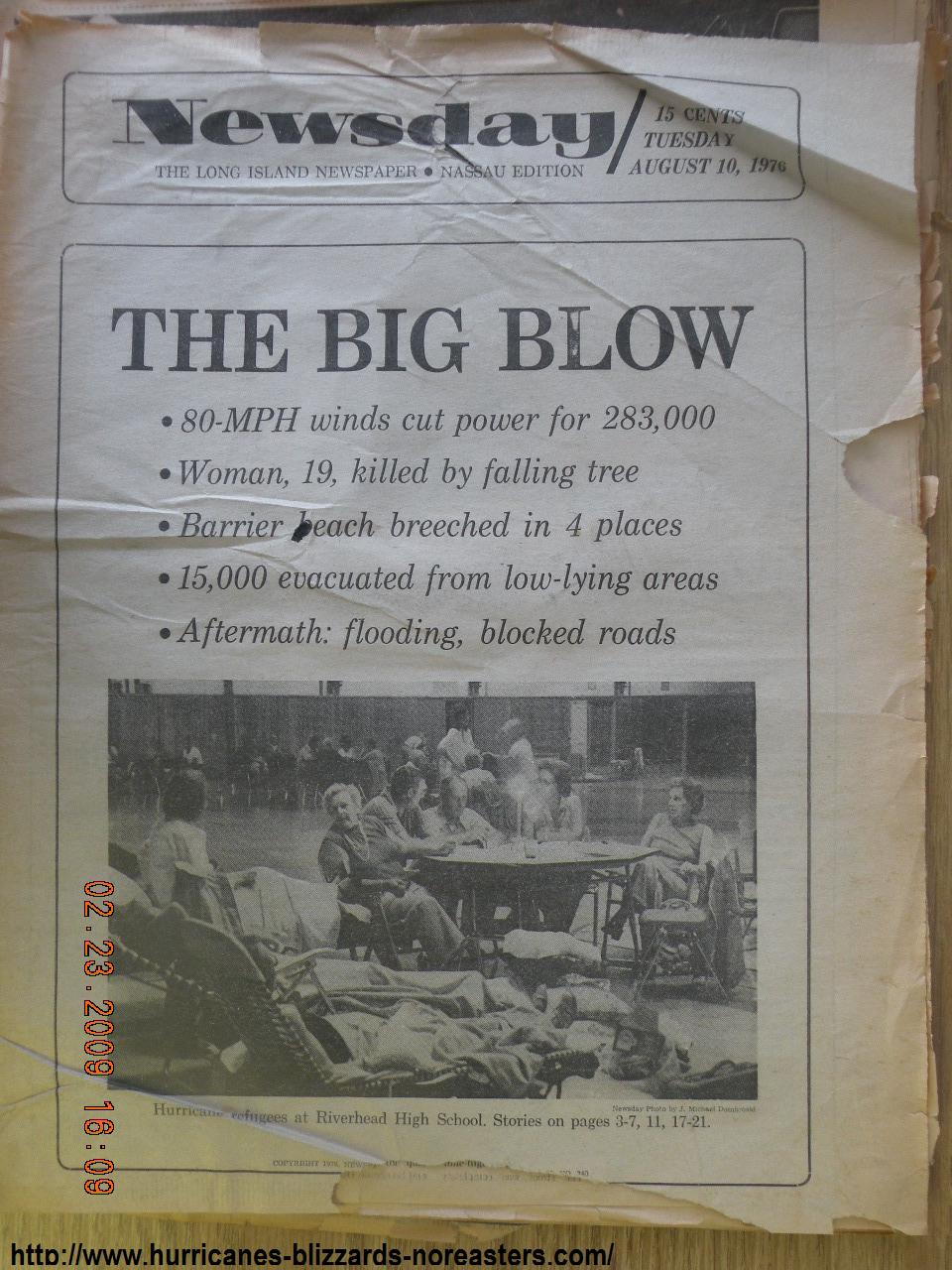
Belle's effects were much less than expected, in part due to its rapid motion of 30 mph (48 km/h) as it paralleled the coastline. Gusts were near hurricane force winds in some locations, though winds were fairly light in most locations from 35 to 45 mph (72 km/h). Storm surge varied from 3 ft (0.91 m) to 4½ ft. above normal.
The greatest effect from Belle was its rainfall. Four to five inches (127 mm) of rain was seen throughout New England and the Mid-Atlantic region. There was considerable small stream flooding, as well as moderate crop damage. The crop damage, combined with widespread property damage, resulted in a total loss of $100 million in damage (1976 USD, $342 million 2005 USD). In addition, Belle was responsible for 5 casualties.
The name Belle was not retired, due to lighter than expected damage and few deaths. However, due to a change in the list of hurricane names in 1979, the name Belle has not been used since.
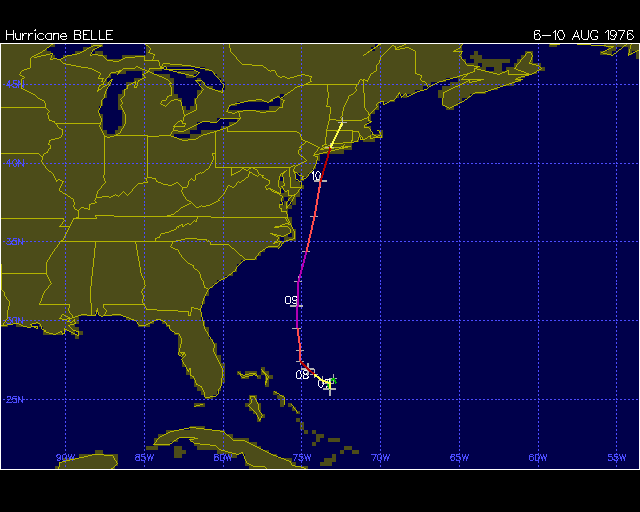
Belle formed as a depression early on August 6th just east of the northern Bahama islands. While a depression, Belle's position remained about 250 miles northeast of Nassau in the Bahamas as the system did a small cyclonic loop. Belle was upgraded to a tropical storm on the evening of 6th and shortly thereafter starting moving northwest.
Belle reached hurricane strength during the late afternoon of the 7th. Movement continued to be northwest and toward the Carolinas before turning to the north on the 8th and passing within 100 miles of the Outer Banks.
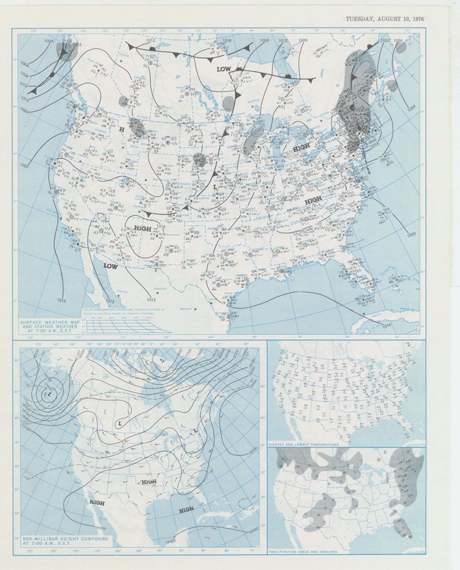
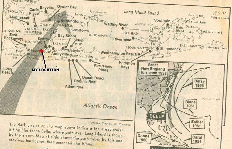
Belle continued to intensify through the 9th when the central minimum pressure dropped to 957 mb and maximum sustained winds reached 120 mph. Weakening commenced later on the 9th and continued through the 10th when the storm made landfall on the south coast of Long Island as a category one storm.
In the Carolinas the highest sustained wind was 37 mph at Cape Hatteras. The highest estimated gust was 75 mph as both Frisco and Hatteras Place on the Outer Banks. 3.70 inches of rain fell at Cape Hatteras.
Source: NOAA.

ARTICLES

PHOTOS
Ocean Ave in Amityville...(Yes the same block as the Amityville horror house)
©
FOR STATE BY STATE TROPICAL SYSTEMS CLICK ON STATE NAME...TEXAS LOUISIANA MISSISSIPPI ALABAMA FLORIDA GEORGIA SOUTH CAROLINA NORTH CAROLINA VIRGINIA DELAWARE MARYLAND NEW JERSEY NEW YORK CONNECTICUT RHODE ISLAND MASSACHUSETTS NEW HAMPSHIRE MAINE

